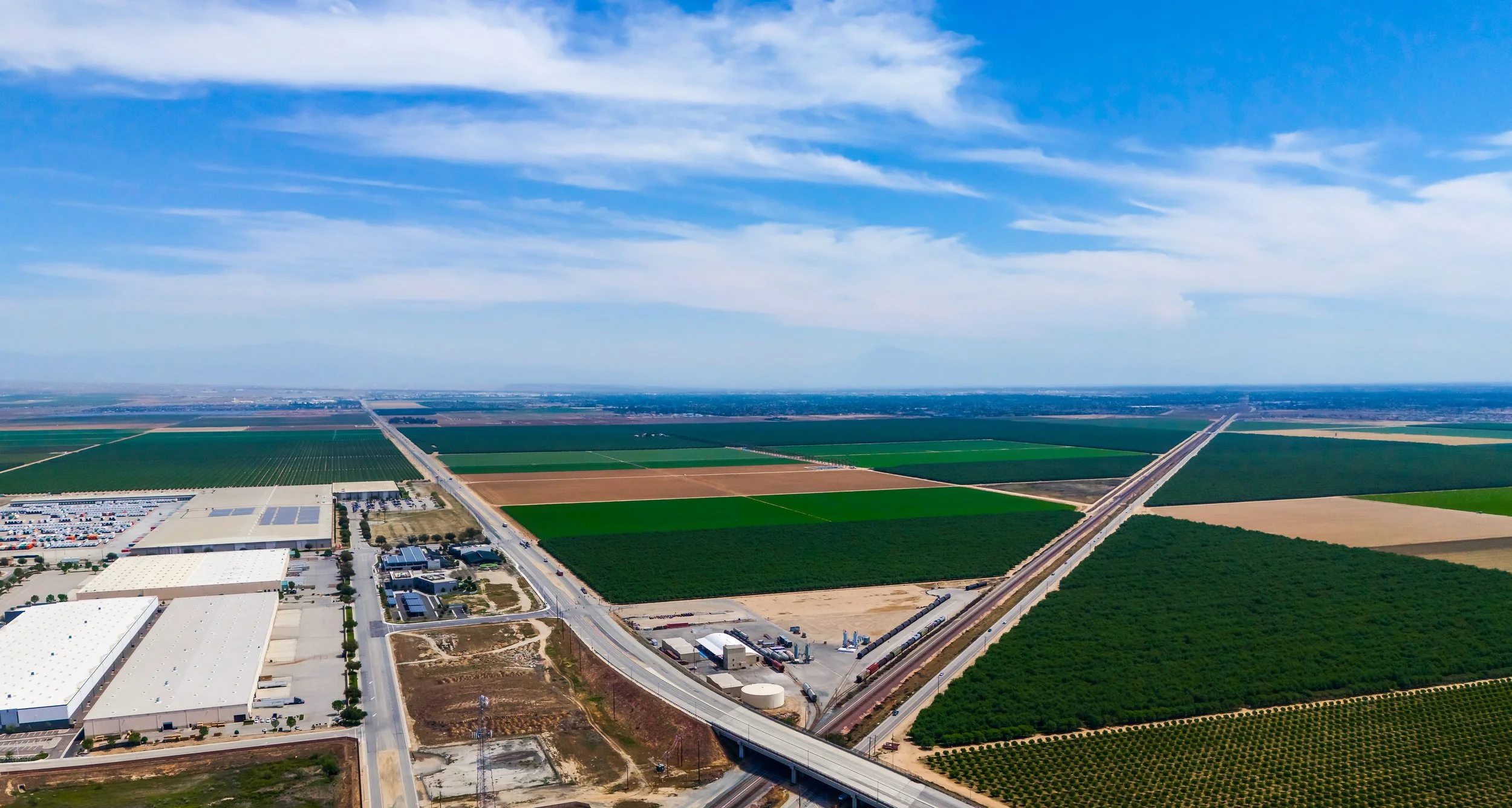
Where Land Meets Limitless Possibility

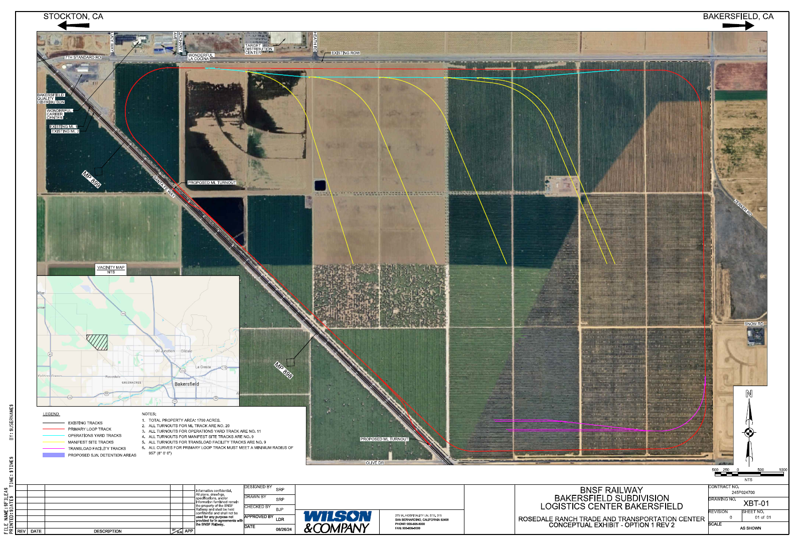
Conceptual Site Layout

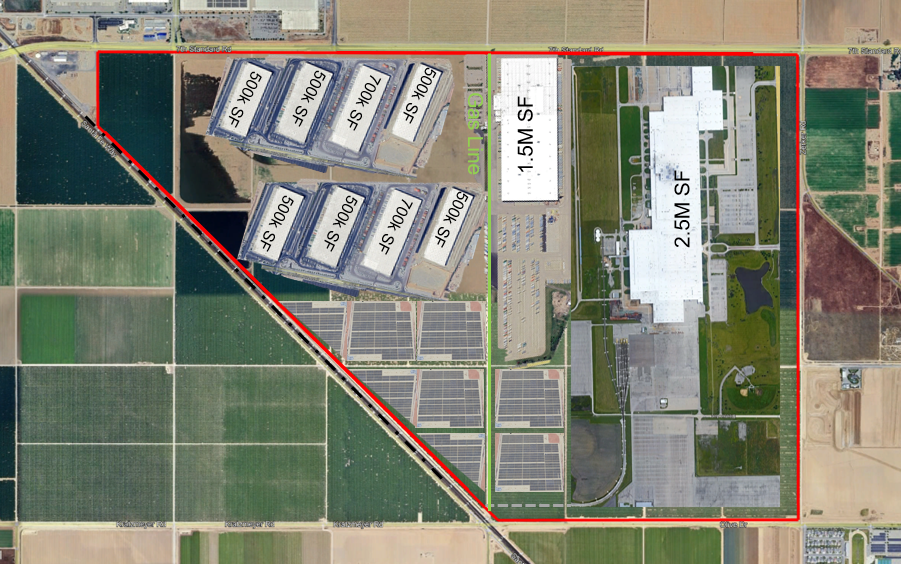
Rail-Served Manufacturing & Distribution

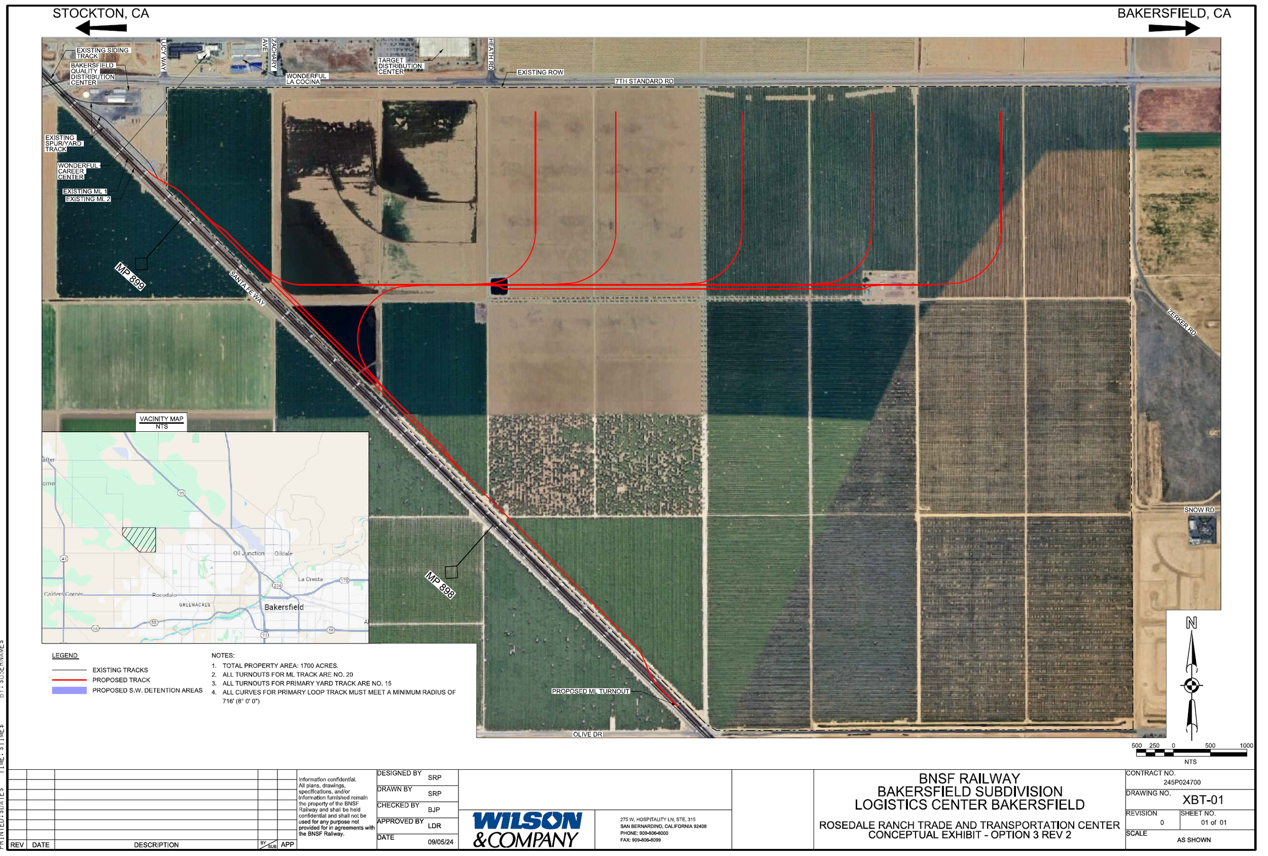
Rail Spur Option 1: Loop track concept with multiple interior spurs across the Ranch

Aerial view schematic of a proposed rail yard near Bakersfield, California, showing existing and new tracks, property boundaries, and turnouts for logistics center development, with roads and fields surrounding the site.
A map legend showing different track types, including existing tracks, primary loop, operations yard, manifest site, transload facility, and proposed detention areas, with color codes and notes on property and track specifications.
A detailed map showing proposed new railway tracks, existing tracks, and land use in Bakersfield, California. Includes labels for nearby roads, property boundaries, and an inset map of Bakersfield.

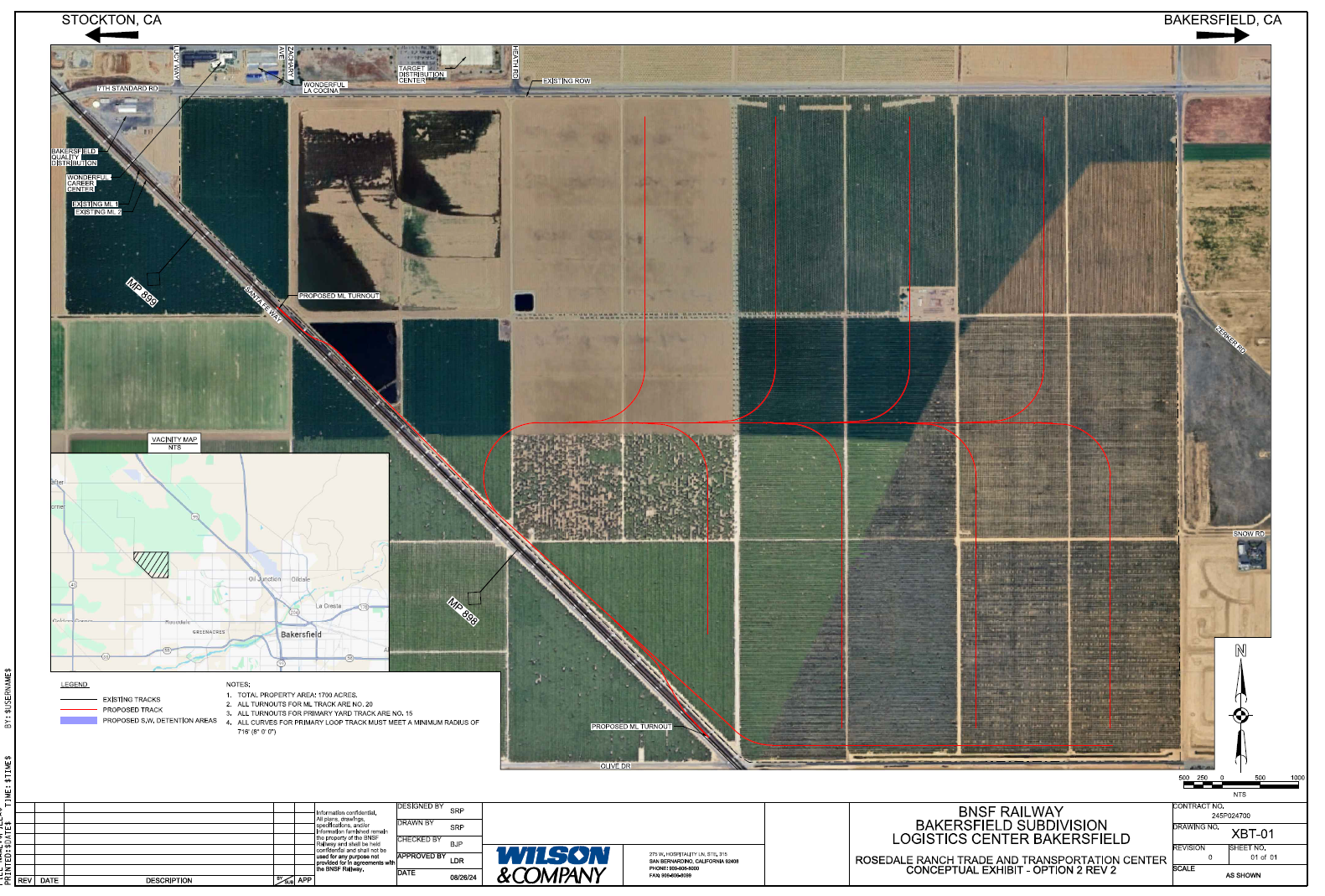
Rail Spur Option 2: Mainline switch access from the center/southern portion of the Ranch

Map legend showing existing railroad tracks in black, proposed tracks in red, and proposed switch detention areas in blue, with notes about property area, turnout counts, and curve radius.

Rail Spur Option 3: QDC transload gateway providing access from the north/northwest (QDC)

Aerial map showing proposed railway track routing through farmland in Bakersfield, California, with red lines indicating new track paths and existing railway lines.
Legend of a track plan with existing tracks, proposed tracks, and detention areas, alongside notes about property area, turnouts, and curve specifications.
A map of a railway corridor showing existing tracks, proposed tracks, and detention areas in Bakersfield, CA, including satellite imagery, with labels for roads and landmarks.

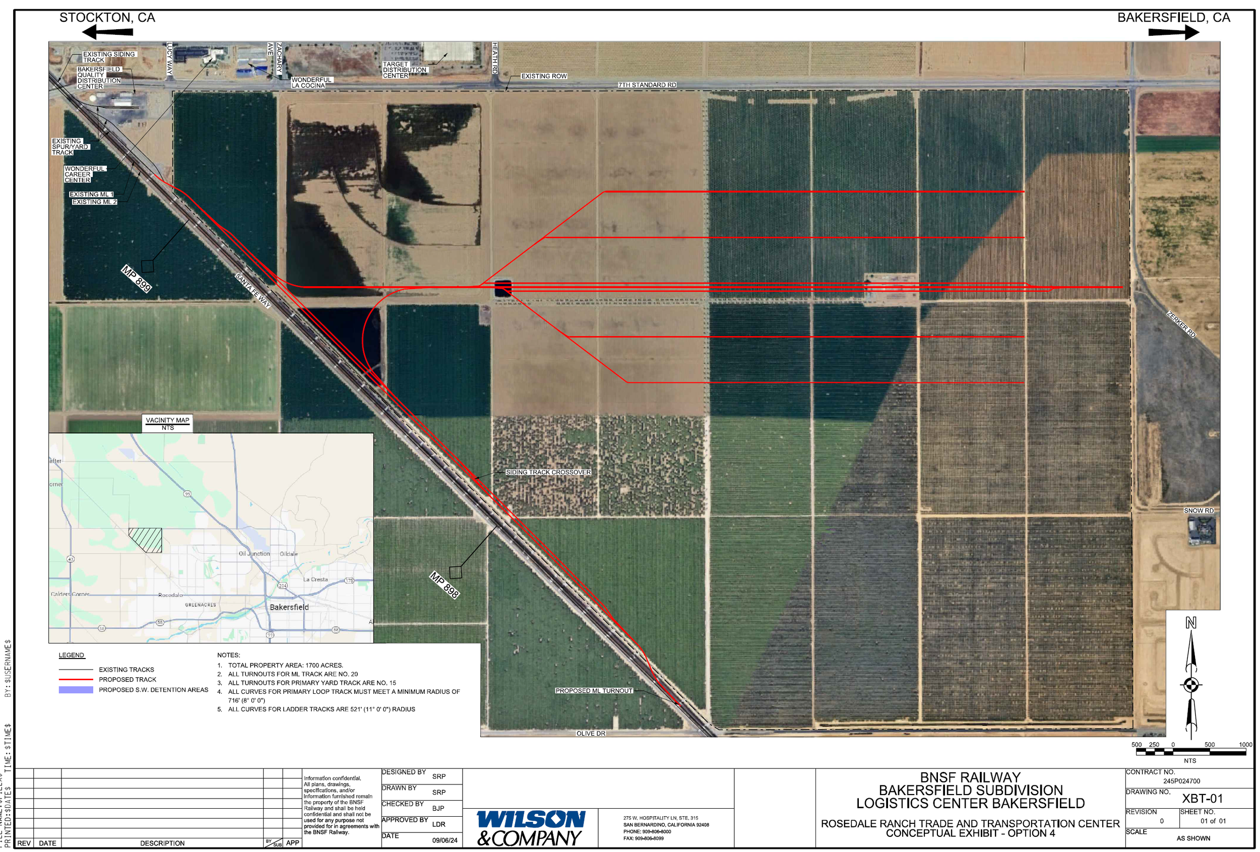
Rail Spur Option 4: Separate direct mainline switch connection at the center/southern portion

Diagram showing existing and proposed railroad tracks with legend and notes about property area, turnouts, curves, and minimum radius for primary loop track.

Manufacturing Megaproject

An aerial view of a large industrial complex with multiple buildings, parking lots, and solar panels. The area is divided into sections with labels indicating different square footage, such as 500 SF, 1.5 M SF, and 2.5 M SF. Surrounding fields and farmland are also visible.

Site Plan

Site map of a residential or commercial development with labeled building footprints, lot sizes in square feet, and surrounding infrastructure.
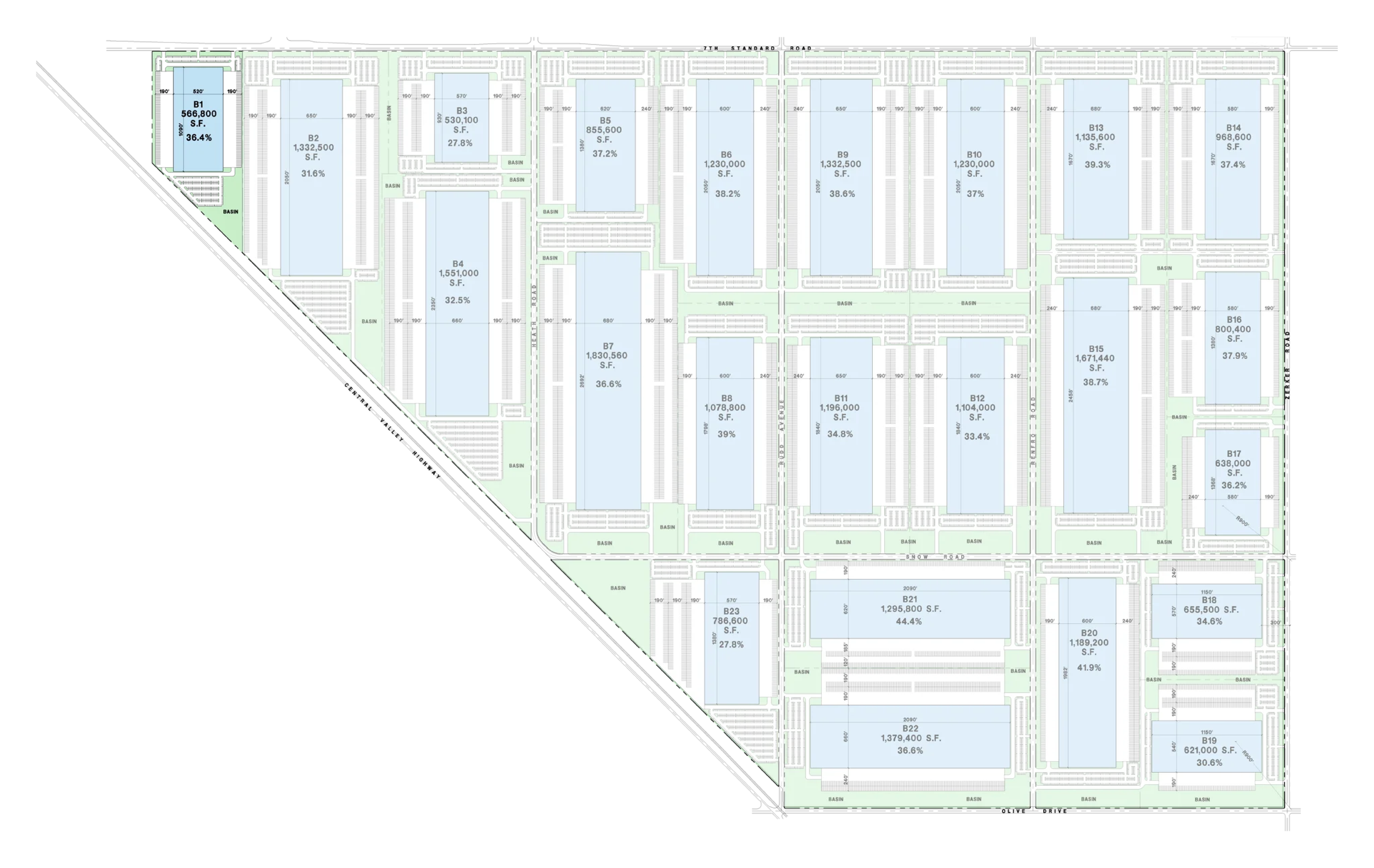
  • B2 – 1,832,500 SF – 31.6% coverage

    B4 – 1,851,000 SF – 32.5% coverage

    B7 – 1,830,580 SF – 36.8% coverage

    B21 – 1,295,800 SF – 44.4% coverage

    B22 – 1,379,400 SF – 36.6% coverage

  • B6 – 1,230,000 SF – 38.3% coverage

    B8 – 1,332,500 SF – 38.6% coverage

    B12 – 1,078,800 SF – 39% coverage

    B17 – 638,000 SF – 36.9% coverage

  • B1 – 668,800 SF – 36.4% coverage

    B5 – 855,800 SF – 37.2% coverage

    B11 – 988,600 SF – 37.4% coverage

    B20 – 1,189,200 SF – 41.9% coverage

    B23 – 786,600 SF – 27.8% coverage

  • B3 – 830,100 SF – 27.8% coverage

    B13 – 1,169,000 SF – 34.8% coverage

    B14 – 1,104,000 SF – 33.4% coverage

    B16 – 800,960 SF – 37.9% coverage

  • B9 – 1,230,000 SF – 37% coverage

    B10 – 1,135,600 SF – 39.3% coverage

    B18 – 655,500 SF – 34.5% coverage

    B19 – 821,000 SF – 30.8% coverage

  • B4 – 1,851,000 SF – 32.5% coverage (dual category: also Mega Distribution)

    B15 – 1,671,440 SF – 38.7% coverage